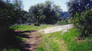
|
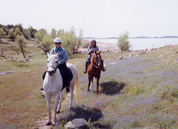
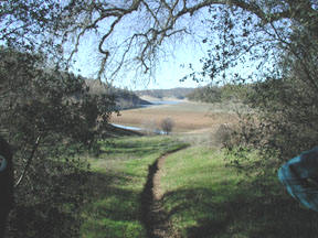
Folsom Lake is ringed by miles of riding and hiking trails,
with beautiful and varied scenery. Spring brings extraordinary wildflowers, and
a year-round upper trail curves around each bend to reveal one beautiful view of
the lake and inlets after another. Footing is generally decomposed granite, so
is excellent all year. When the water is low enough, the lower trail has soft
sand footing and room to canter here and there. You can see an amazing amount of
wildlife, from hummingbirds to hawks, from ducks to deer. Look for bobcat,
turkey, rattlers, even mountain lions. Wear long sleeves to protect yourself
from the colorful poison oak; wear a helmet for, in addition to the usual
reasons, low branches.
|
Lake side during low water |
Trails are extremely well maintained by State Parks
and the Folsom Trail Patrol volunteers, and are improved often, when
necessary. You cross several well-made bridges, and there are occasional
picnic tables in clearings.
Trails are easily accessible from at least 8 staging areas. The Folsom
Lake Trail Patrol sells an excellent map available for a small fee from
Goldfield District Headquarters (Folsom Dam Road & Folsom-Auburn Rd.),
Negro Bar kiosk, and Beal’s Point kiosk.The
trails on the west side of the lake have mileage markers that refer to
distance from the “0” beginning point, Discovery Park in Sacramento.
This is the Pioneer Express Trail, maintained by State Parks. |
Almost
all of the trail is restricted to equestrians, with a separate bike trail
running parallel to it as far as Beal’s Point. There is a “yellow-ribbon”
multi-use trail loop at Granite Bay. Above the Granite Bay entrance, only horses
and hikers may use the trails.
Negro
Bar Staging Area (Folsom) [Mile 28]: 3/10 mi. west of Folsom-Auburn Road,
off Greenback. Pay $5 (as of 5/03) to park, and obtain a map at the kiosk.
Trailer across the bike trail, then turn right towards the picnic tables sign to
park in the large horse staging area. There is a water trough, bathroom,
drinking fountain, and hitching posts.
Directly across the bike path from the staging area,
signs direct you up the hill to the Pioneer Express Trail. If you head north to
Folsom Lake, you will take your horse under the various bridges in Folsom--you
may want to dismount .
If you head south, you will weave in and out of
huge piles of river rock dislodged during gold-mining days. You frequently
ride close to the river. River rocks on the trails make footing difficult
for some horses with tender feet. The trail below Negro Bar seems like a
trip throught local mining history.
Granite Bay Staging Area [Mile 37.1]: Drive in from Douglas Blvd. Pay at
the kiosk, and drive straight until you turn left into the horse staging area,
with room for 40 rigs. Here you will find hitching rails, bathroom, watering
trough and shaded picnic tables. You can head south toward Beal’s Point on
trails that are frequently wide enough to ride side by side. The terrain is
relatively easy, with no drop-off cliffs: a good spot for inexperienced horse or
rider. Going towards Beal’s Point you will run into a little more civilization
than if you head north, where you will have the trails more and more to
yourself. As you cross the dirt access road to Twin Rocks Road, heading north,
you can find several multi-use loops that reach Doton’s Point and Beek’s Bight,
via beach-side trails. |
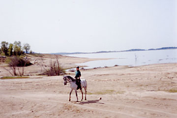
Out on
the sand |
Los Lagos Trail [Mile 38.5
(approx)]: In Granite Bay, this 1.2 mile trail leaves the lake trail and
loops through the Los Lagos housing development, crossing several streets
and ending at a gate to Auburn-Folsom Road. Very easy trails, with
occasional gardeners or dogs to amuse your horse While on the trail, turn at
the pond to get to the Los Lagos Equestrian Center.
Sterling Pointe Staging Area (Loomis area) [Mile
42.5]: From Auburn-Folsom Road south of Horseshoe Bar Road, turn towards the
lake on Lomida Lane (opposite Knicker Knob stable), and follow the signs to the
4.8 acre staging area owned by the County.
|
Sterling Point Trail heading to Folsom Lake |
Please drive slowly through the
residential area. The large staging area is gated, with the gate open dawn
to dusk. There is a beautiful horse water trough, drinking fountain for
riders, picnic tables, a bathroom, and even a dog water trough, thanks to
efforts by Donna Williams in 2000. Loomis Basin Horsemen’s Association also
contributed a large amount of time and energy in securing and setting up
this staging area. The Audubon
Society has set up an impressive display board of bird photographs. Always
improvements here; this staging area gets better and better. You are
requested to remove horse manure from the staging area if possible, to
forestall objections from neighboring homeowners. |
These trails in Loomis range from easy double-wide
dirt roads to average steep lake access with rocks here and there on narrow
trails. In general, the trails on the Auburn-Folsom side of the parking area
are easy and safe (once you negotiate the driveways of the development);
those on the lake side are more challenging. The easier trails are part of a
large parcel (about 600 acres) of private property, not gated or restricted
as of 2/2003. You can ride there for hours, crisscrossing under the trees.
Keep your ears peeled for the whine of ATVs, whose drivers have discovered
this area also. Or, you can parallel the lake, with directional signs to
help you stay oriented. Trails are marked into and out of Sterling Pointe
Equestrian Staging area, from the Pioneer Express Trail. The trails through
the private property (600 acres) are excellent for beginner or timid riders,
for young or inexperienced horses, for reconditioning or for horses with
stiff joints. Footing is good nearly any time of year (although you should
watch for bogs after long wet periods); in summer, lots of shade. The
Pioneer Express Trail between Eden Roc and Sterling Pointe developments is
steep and rocky in several spots, very manageable for experienced trail
horse and rider, but intimidating to beginning trail horse or rider.
However, it is a remote and beautiful stretch of trail.
Rattlesnake Bar Staging Area (Newcastle) [Mile 46]: From King Road in
Loomis, go towards Auburn on Auburn-Folsom Road. Turn right on Newcastle Rd.
Continue to bear right; don’t turn left on Rattlesnake Rd. Go 3/4 mi.
downhill to the kiosk to pay. Inside the park, go straight ahead on the dirt
road, where there is parking for 15 or so rigs. There is no drinking
fountain here, but there is a picnic table under the trees, and a portapotty.
A new staging area is being completed at the Rattlesnake Bar boat ramp, on
the left paved road going toward the boat ramp. Horses can drink from the
lake.
If you ride south toward Granite Bay, you will find access to a lower trail
when the water is low. This trail is usually covered at least in part once
the snow is melting fast. Easiest access is from the picnic tables about 20
minutes past Horseshoe Bar. The upper trail is rideable year-round. In this
direction, you will cross a few bridges, a little water, and climb down some
rocks. Watch out for “Knee Rock,” where many riders get a bruise or two!
Riding north toward Auburn, when the trail splits, you have a choice of 3
drop-offs on the right, or switchbacks on the left. When the trail converges
again, you still must ride past a steep drop-off cliff. You pass a bubbling
horse trough, then Avery Pond, particularly gorgeous in the Spring with the
yellow iris blooming around the edges. Look for the kingfisher rattling and
diving. There are picnic tables here, although no hitching rails. Further
on, you cross a bridge over the river at the pumping station for the PCWA--this
can be quite exciting when the snow is melting! You can continue to Auburn.
Auburn Staging Area: From Auburn-Folsom Road,turn onto Pacific Ave
toward the Auburn Dam Overlook. Cross Sacramento Street, pass the paved
overlook parking, then turn right into the next drive with the sign “Western
States Trail Auburn Staging Area.” Here there is water for both horses and
people, picnic tables, a bathroom, and plenty of horse trailer parking. From
here you can connect to the Western States Trail and the Robie Trail in Cool
and other park trails in El Dorado County: Poverty Bar, RuckaChucky, and Dru
Barne r Park. Or you can border the west side of the lake and ride all the
way to Discovery Park in Sacramento.
| Brown’s
Ravine Staging Area (El Dorado Hills) [ 6 miles up along the east side
of the lake from Folsom Point]: E. Natoma in Folsom,
then left onto Green Valley Road. [Note: the Dam Road has been
closed to all trafic for security.] Make a left at Brown’s Ravine Marina
sign. After paying at the kiosk, the staging area for 10 trucks is to the
right on the hillside, with hitching posts, picnic tables, water trough,
water fountain, and bathroom available. If you are coming from the Loomis
area, the Dam Road has been closed so you will have to go through old town
to E. Natoma then left onto Green Valley Rd to reach Browns Ravine. Here is a review of the trail from the Loomis
Basin Horsemen’s Association newsletter: “The Brown’s Ravine trail heading
toward Salmon Falls was considered to be a medium to easy ride for
equestrians and medium for hikers/joggers. The trail is rocky and mostly
about 18 inches wide. It is considered single track. |
A scene along the Brown's Ravine Trail
|
There are many switchbacks on the trails
and blind corners. The terrain is hilly and there are many small
streams/washes that had to be crossed. Most had culverts or flat rock placed
in them for ease of crossing.......On the first part [3.5 miles] of the trail it
was about 50/50 for bikes to horses, however, from mile 8 on no bikes or
bike tracks were encountered.”
Falcon Crest Staging Area (El Dorado Hills): [Mile 17.5] Continue past
the Brown’s Ravine entrance and make a left on Pilot Hill/Salmon Falls Rd.
Go about 3 miles until you get to the large Falcon Crest sign on the left.
The staging area is a good-sized gravel parking area, immediately off Salmon
Falls Road. There is a water trough, fountain, and picnic tables available
on a ridge overlooking the South Fork of the American River on the Monte
Vista Trail North. Trails are well-marked. A bathroom is available near the
Monte Vista trailhead. Selections from the review in the LBHA newsletter,
9/2000: “This section of the trail [mile 17.5 to mile 12.5]
was....considered fairly easy for both horses, hikers or joggers. Most of
the trail was 18 inches wide, but there were sections that were also 6-8
feet wide. Switchbacks were less than on the first section of the trail and
stream/wash crossings were not as well maintained as on the [Brown’s Ravine]
section. All were passable, some with care......there are many open spots,
good line of sight, no major drop-offs, and many existing side trails that
could be used to split
the trail where needed [to avoid bikers or hikers].”
|